The Case of Río Blanco, Ecuador |
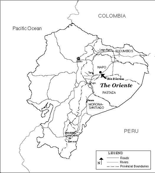
 Even more than is the case with most industries, tourism is intimately associated with place. The place, and the people who live and work there, are not only the providers of the goods and services related to tourism, they are also the product--that which attracts tourists to visit this place instead of another. Thus, even with conventional mass tourism, the geography, economy and culture of a tourist destination are central to any study of the tourism enterprise there. Place takes on even greater importance in ecotourism, since any such project must be carefully integrated into the local economy and culture in order to minimize negative impacts and maximize benefits. Río Blanco's location in Napo Province in the Ecuadorian Amazon is of great significance not only to the origin of its ecotourism project but to its potential as well.
Physical and Human Geography of Napo Province
Even more than is the case with most industries, tourism is intimately associated with place. The place, and the people who live and work there, are not only the providers of the goods and services related to tourism, they are also the product--that which attracts tourists to visit this place instead of another. Thus, even with conventional mass tourism, the geography, economy and culture of a tourist destination are central to any study of the tourism enterprise there. Place takes on even greater importance in ecotourism, since any such project must be carefully integrated into the local economy and culture in order to minimize negative impacts and maximize benefits. Río Blanco's location in Napo Province in the Ecuadorian Amazon is of great significance not only to the origin of its ecotourism project but to its potential as well.
Physical and Human Geography of Napo Province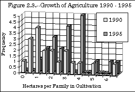
| 1990 | 1995 | Change | |
|---|---|---|---|
| Subsistence Crops | - | 15 | - |
| Cash Crops | - | 44 | - |
| Total | 38 | 59 | 55% |
| 1990 | 1995 | Increase | |
|---|---|---|---|
| Subsistence | - | .10 | |
| Commercial | - | .42 | |
| Total | .28 | .48 | 71% |
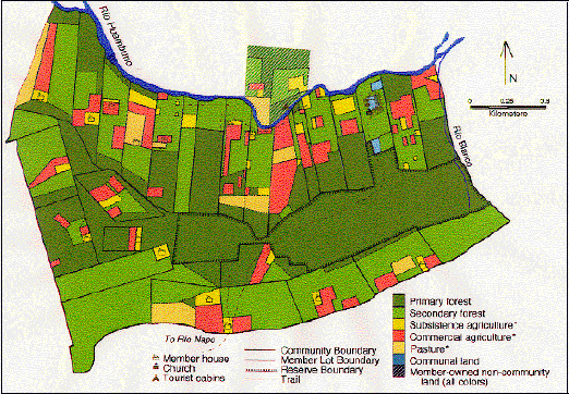
| Average Family Lot | All Land in Community | |||
|---|---|---|---|---|
| 1990 | 1995 | 1990 | 1995 | |
| Agriculture (w/pasture) |
21% | 28% | 11% | 16% |
| Primary Forest | 37% | 27% | 58% | 48% |
| Secondary Forest | 41% | 45% | 31% | 36% |
 to
Ecotourism Research Home Page
to
Ecotourism Research Home Page
 to
Río Blanco Summary Page
to
Río Blanco Summary Page
 to
Río Blanco Section Two
to
Río Blanco Section Two